Research & Monitoring Activities
Research and monitoring are central to the mission of the Connecticut National Estuarine Research Reserve (CTNERR) and support informed stewardship, management, education, and coastal decision‑making. The Reserve serves as a platform for place‑based research that advances understanding of estuarine ecosystems, evaluates responses to environmental stressors, and informs adaptive management in southeastern Connecticut and Long Island Sound.
As part of the National Estuarine Research Reserve System (NERRS), the CTNERR participates in nationally coordinated monitoring programs while also supporting site‑specific and collaborative research that addresses regional priorities and management needs.
(((((https://experience.arcgis.com/experience/49e8af83bc7f44bd99d21887902bb054 (add SWMP locations to mapviewer) NOT SURE HOW THIS FITS HERE)))
Explore Further
- External Link
- External Link
- External Link
Deeper Dive
Learn More
Featured and Highlights/Section Call Outs
Research and Monitoring Priorities
Lorem ipsum dolor sit amet, consectetur adipiscing elit, sed do eiusmod tempor incididunt ut labore et dolore magna aliqua.
Guidance for Engagement with Reserve Communities
Lorem ipsum dolor sit amet, consectetur adipiscing elit, sed do eiusmod tempor incididunt ut labore et dolore magna aliqua.
Research and Monitoring Activities
Lorem ipsum dolor sit amet, consectetur adipiscing elit, sed do eiusmod tempor incididunt ut labore et dolore magna aliqua.
Publications and Online Bibliography
Lorem ipsum dolor sit amet, consectetur adipiscing elit, sed do eiusmod tempor incididunt ut labore et dolore magna aliqua.
4.a. Research and Monitoring Priorities
In addition to long‑term monitoring, the CTNERR supports applied and basic research that addresses regional environmental challenges and management needs. Research priorities are adaptive and informed by Reserve programs, community partners, and coordination with national NERRS initiatives. Key research themes discussed in our management plan include:
- Climate Change: How are the dominant physical, ecological, and socio-demographic attributes that characterize reserves and their targeted watersheds affected by climate change?
- Water Quality: What is the status of water quality in reserves? What are the natural and anthropogenic drivers that are causing water quality changes? What are the impacts of those changes on reserve ecosystems, including their associated human communities?
- Habitat Protection: What is the magnitude and variability of ecosystem change in reserve targeted watersheds and their State of Connecticut-defined or federally-designated ESA Critical Habitats? What are the relative influences of environmental and anthropogenic drivers in initiating and sustaining these changes? How do reserve ecosystems and reserve habitats respond to ecosystem change?
((((THESE COULD BE A MORE INTERESTING LAYOUT IF THERE WERE PHOTOS OR ICONS OR SOMETHING)))
4.a.i. Current Management Needs
Research priorities as described by management needs are updated annually and inform the priorities for Davidson Fellowship projects, the NERRS Science Collaborative, and other partner‑driven initiatives. Find current management priorities on the NERR Science Collaborative site.
((((these are accordions in two columns. Could also be cards or detail expansion)))
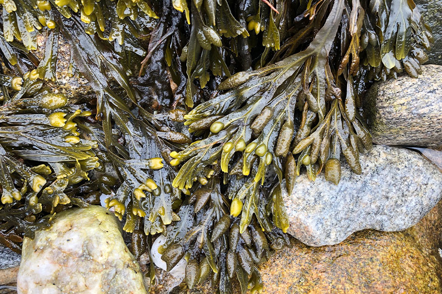
SAV Research and Restoration
Eelgrass and shellfish thrive in Long Island Sound and shellfish aquaculture is an important economic driver. It is important to understand these natural habitats individually and their collective benefits and challenges. But knowledge of these interactions is lacking, and existing guidance does not utilize current scientific data and analysis, including an understanding of trends across the reserve system. Therefore, by better understanding the ecological connections of these resources and the research needs of regulatory and industry communities, the Reserve can support collaborative efforts to protect the presence and growth of both eelgrass and aquaculture.
Keywords: Seagrasses and Other Submerged Aquatic Vegetation; Management; Other-Shellfish; Ecosystem Services
Focus Area: Habitat Adaptability
Needs: Management and Knowledge Exchange
Digging Deeper

Connecticut River Museum (Connecticut River)site is designated for the meteorological monitoring station.
Connecticut River Museum (Connecticut River)site is designated for the meteorological monitoring station.
Connecticut River Museum (Connecticut River)site is designated for the meteorological monitoring station.
Data Analysis
Natural and anthropogenic factors act at multiple spatiotemporal scales to drive change in estuarine ecosystems. Understanding and attributing change to relevant drivers and pressures is essential for assessing current management and adapting it for greater effectiveness. Long Island Sound has a wealth of relevant data. But sophisticated analyses are needed to tease out relationships. Therefore, we are interested in quantitative measures that synthesize existing data and developing an updatable approach as new data become available, both for local needs and to integrate our data with the syntheses efforts of long-term, system-wide monitoring data collected across the NERRS.
Keywords: Data Analysis, Data Mining, and Visualization; Water Quality; Habitat; Anthropogenic Impacts
Focus Area: Change Analysis
Needs: Management & Knowledge Exchange
Nature-Based Infrastructure
Estuarine habitats and coastal communities are threatened by environmental changes such as flooding, and nature-based infrastructure is often promoted as a method of increasing resilience. But the ecosystem services provided and the impact on communities is largely under-assessed at the local level, and monitoring programs are often neither robust nor durationally relevant. Therefore, more research and an emphasis on monitoring is needed on the ecological efficacy of these mitigation strategies to coastal habitats – especially wetlands and intertidal areas – as well as social science research to better understand the challenges and opportunities these strategies may offer.
Keywords: Nature-based Solutions; Monitoring; Resilience; Socioecology
Focus Area: Community Resilience & Adaptability
Needs: Management & Knowledge Exchange
Focus Area: Habitat Adaptability
Needs: Management & Knowledge Exchange
Land Use Change/Eutrophication
Continuing attention to water quality and habitat quality are necessary to support system integrity. Recent nitrogen loading estimates, high resolution land-use mapping, and planned modeling of embayments advances the information available to inform decision makers and the public. But assessments related to habitat and water quality within the reserve boundaries are intermittent or lacking. Therefore, a broadscale assessment within the reserve’s aquatic and terrestrial environments are necessary to make the link between loading and land-use data and expressions of impact such as eutrophication in the estuary and watershed.
Keywords: Habitat; Anoxia and Hypoxia; Water Quality; Eutrophication
Focus Area: Watershed Dynamics
Needs: Management & Knowledge Exchange
Ecosystem Services
Assessing the value of ecosystem services is an important part of effective resource management. Current recommendations in Connecticut include preserving and restoring forests and coastal wetlands as a means of enhancing ecosystem services. These resources are known as important sinks in biogeochemical cycling but their status here is not well understood. Therefore, research and monitoring assessing the boundaries, typology, and capacity in these habitats is critical for preservation priorities, assessing their contribution to state goals, and setting restoration targets within the Reserve watershed and aquatic areas.
Keywords: Ecosystem Services; Nutrient Cycling; Wetlands; Coastal Forests
Focus Area: Habitat Adaptability
Needs: Management & Knowledge Exchange
4.b. Guidance for Engagement with Reserve Communities
The CTNERR encourages collaborative research that benefits both scientific advancement and coastal communities. Research activities are designed to connect science with policy, management, and education while remaining responsive to local and regional needs.
((([JV – need a research engagement policy – see Hawaii example, and the other examples available))))
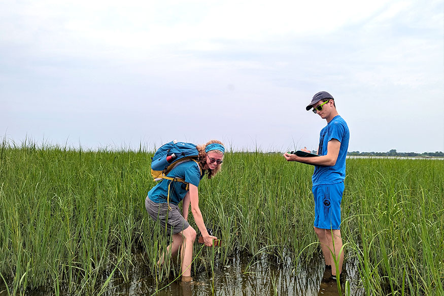
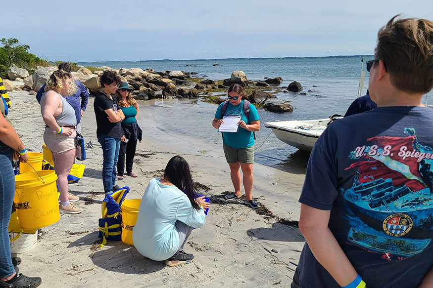
4.c. Research and Monitoring Activities
((((JV – This could be a list, a zotero database, or little write-ups – we could include a mapviewer, links to products. We could use an accordion to expand projects. Projects could be grouped by the management priorities. EW – LOTS of options here depending on how many, how much content, links out, etc. Cards might be good. ))))
4.c.i. Research Activities
> Current Projects
text text text projects projects projects
> Past Projects
text text text projects projects projects
4.c.ii. System‑Wide Monitoring Program (SWMP)
All NERRS sites participate in the System‑Wide Monitoring Program (SWMP), which provides standardized, long‑term environmental data collected using consistent protocols across the national Reserve System. SWMP data support assessments of estuarine condition, detection of long‑term trends, and comparative analyses among reserves.
At the CTNERR, SWMP focuses on continuous monitoring of water quality, meteorological conditions, and water chemistry to track changes driven by climate variability, watershed inputs, and human activities.
> Monitoring Parameters
Meteorological monitoring
One permanent meteorological station will operate year‑round, recording data at 15‑minute intervals, including:
- Air temperature
- Relative humidity
- Barometric pressure
- Wind speed and direction
- Precipitation
- Photosynthetically Active Radiation (PAR)
Water quality monitoring
Four permanent water quality stations will deploy continuous, in‑situ sondes positioned approximately 0.5 meters above the bottom. These stations will measure:
- Chlorophyll
- Water temperature
- Specific conductivity
- Dissolved oxygen (% saturation)
- Pressure (water depth)
- pH
- Turbidity
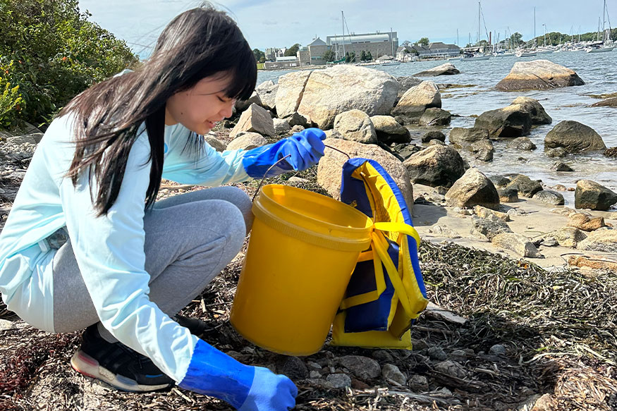
Water chemistry monitoring
Discrete water chemistry sampling will occur monthly at each water quality station, with samples collected once per day at low tide to ensure consistency across sites. In addition, each month one water quality station will be selected for intensive diel sampling, with discrete samples collected every 1–2 hours over a 24‑hour period. Monthly discrete and diel samples will include analyses of:
- Nitrate
- Nitrite
- Ammonium
- Orthophosphate
- Chlorophyll‑a
((((these are cards with the detail option that opens with the arrow))))
This sampling design captures both spatial variability among stations and short‑term temporal variability associated with tidal and diel cycles, while remaining consistent with System‑Wide Monitoring Program protocols.
> Monitoring Locations and Rationale
The CTNERR has identified five locations for SWMP stations that collectively represent the diversity of hydrologic, ecological, and land‑use conditions within the Reserve.
(((I say had a static image of the sites here, maybe right-side column, and link to map viewer)))
Connecticut River Museum (Connecticut River) site is designated for the meteorological monitoring station. Its location complements nearby regional weather stations and a U.S. Geological Survey water quality station, strengthening integration across monitoring networks. The site also provides reliable long‑term access and supports connections to education and outreach activities.
Connecticut College (Thames River) water quality station is located along the Connecticut College waterfront in the lower Thames River. The site represents one of the largest riverine inputs to Long Island Sound and captures conditions within a highly developed watershed. Its proximity to an established living shoreline also provides context for linking monitoring data with applied management efforts.
Roger Tory Peterson Estuary Center (Lieutenant River) station represents a shallow coastal embayment within the western portion of the CTNERR. Due to seasonal ice formation, monitoring will occur seasonally, with the sonde removed during winter months. This site supports understanding of brackish estuarine processes and tidal marsh connectivity.
UConn Avery Point Campus will host a temporary water quality station to evaluate the long‑term feasibility of continuous monitoring. Pilot deployment will assess flow patterns, vessel activity, and sediment dynamics specific to this nearshore setting. Findings will inform whether the site is suitable for permanent monitoring within the Reserve network.
Bluff Point State Park/Poquonnock River site is selected as a long‑term water quality monitoring location representing a shallow coastal embayment at the eastern end of the CTNERR. Monitoring will begin following completion of a U.S. Geological Survey effort at the site, with deployment of a continuous bottom‑mounted sonde. This location complements riverine monitoring sites by capturing embayment conditions influenced by both riverine and marine processes.
((((these are stacked rows with 2 columns. Left is the photo, right is the text. Could also be cards but 5 is a tough number))))
> SWMP Data Management and Accessibility
All SWMP data collected by the CTNERR will be submitted to the NERRS Centralized Data Management Office (CDMO), where data are quality‑controlled, archived, and made publicly accessible. CDMO ensures data consistency across reserves and supports national‑scale analyses, visualization tools, and data products.
Public access to SWMP data strengthens transparency, supports research and education, and enables use of Reserve data by scientists, managers, educators, and decision‑makers.
4.d. Publications and Online Bibliography
((((JV – Include a link to our Zotero database – can we default to reserve publication tags?))))