Community & Historical Ecology
The landscapes and waters that comprise the Connecticut National Estuarine Research Reserve (CTNERR) have been shaped by centuries of interaction between natural processes and human activities. Indigenous use, European settlement, maritime commerce, land conversion, and modern conservation and restoration efforts have all influenced the structure and function of estuarine and coastal ecosystems within the Reserve.
Understanding this historical and community context provides critical perspective for interpreting present‑day ecological conditions and for guiding stewardship, research, and management activities within the CTNERR.
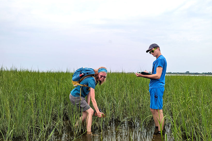
Lorem ipsum dolor sit amet, consectetur adipiscing elit, sed do eiusmod tempor incididunt ut labore et dolore magna aliqua.
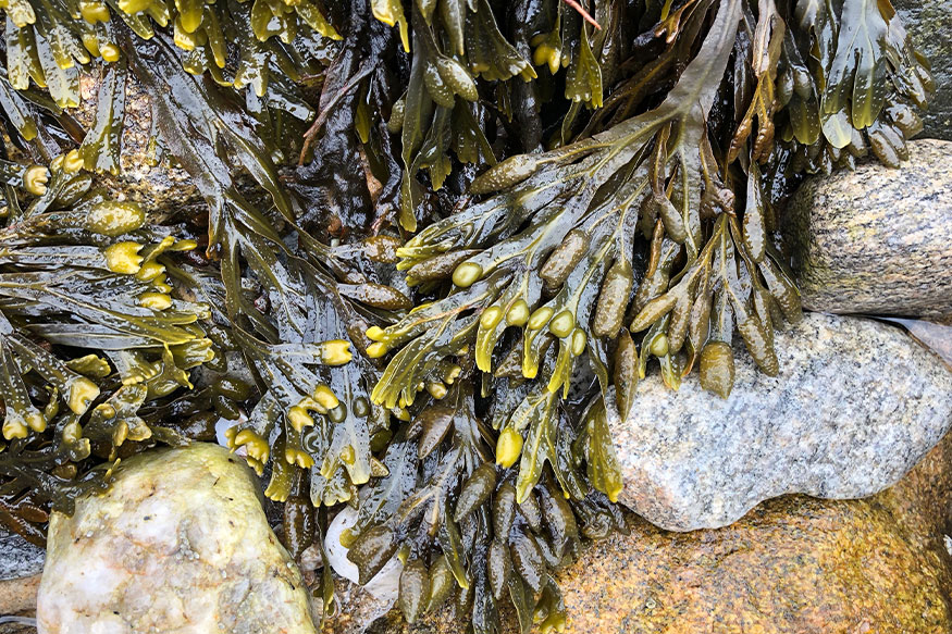
Lorem ipsum dolor sit amet, consectetur adipiscing elit, sed do eiusmod tempor incididunt ut labore et dolore magna aliqua.
Indigenous Acknowledgement
The Connecticut National Estuarine Research Reserve is located on the traditional homelands and waters of Indigenous peoples who have lived in relationship with this region for thousands of years. These include, but are not limited to, the Mohegan Tribe, the Mashantucket Pequot Tribal Nation, the Eastern Pequot Tribal Nation, the Wangunk people, and the Nehântic (Neantic) people, whose territories encompassed the lower Connecticut River, Thames River, eastern Long Island Sound, and associated coastal and estuarine environments.
Indigenous peoples of this region maintained complex systems of governance, trade, spirituality, and seasonal land and water stewardship long before European contact. Their knowledge, lifeways, and management practices shaped the landscapes and ecosystems that persist today. The CTNERR recognizes the enduring presence, sovereignty, and cultural continuity of Indigenous peoples in Connecticut and acknowledges their ongoing connections to the lands and waters within the Reserve.
This acknowledgment is offered in recognition of Indigenous histories, contributions, and continued relationships to place, and in support of respectful engagement as the Reserve advances research, education, stewardship, and coastal resilience.
2a Historic Impacts and Restoration Efforts
i. History of land and water management
ii. Restoration and remediation efforts within the Reserve
iii. Land and water stewardship and conservation activities
2.a.i. Indigenous Peoples and Long‑Term Stewardship of the Region
The lands and waters that now comprise the Connecticut National Estuarine Research Reserve have been inhabited and stewarded by Indigenous peoples for more than 10,000 years. Archaeological evidence, oral traditions, and historical records synthesized by Lavin (2013) document a continuous human presence in southeastern Connecticut from the Paleo‑Indian period through European contact.
Early Indigenous communities adapted dynamically to profound environmental change, including glacial retreat, sea‑level rise, and the formation of Long Island Sound as an estuary. Subsistence strategies evolved over millennia to reflect shifting climates, habitats, and resource availability, with people practicing highly mobile seasonal rounds that integrated inland forests, rivers, tidal marshes, estuaries, and nearshore marine waters.
By the Archaic and Woodland periods, Indigenous peoples in the lower Connecticut River valley and eastern Long Island Sound region maintained complex economies based on fishing, shellfishing, hunting, plant gathering, and later limited horticulture. Coastal and estuarine environments—particularly salt, brackish, and freshwater tidal marshes—supported highly productive food systems and were central to cultural, economic, and spiritual life. Archaeological sites along the Connecticut and Thames Rivers, as well as submerged and shoreline sites now within or adjacent to the CTNERR, document extensive use of fish weirs, shell middens, canoe travel, and long‑term occupation of riverine and coastal settings.
Indigenous stewardship practices actively shaped the landscape. These included the use of controlled fire to manage forests and create productive edge habitats; selective harvesting of plants and animals; and careful regulation of hunting and fishing practices, such as avoiding harvest of females with young. Together, these practices promoted ecological resilience and sustained resource availability over generations.
At the time of European contact in the early 17th century, southeastern Connecticut was home to multiple distinct but interconnected Indigenous nations, including the Mohegan, Mashantucket Pequot, Eastern Pequot, Wangunk, Nehântic, and others. These communities maintained defined territories, governance systems, trade networks, spiritual traditions, and seasonal settlement patterns closely tied to the estuarine and riverine environments of the region.
Despite dramatic population loss following European contact due to introduced diseases, dispossession, and restrictive colonial policies, Indigenous peoples remain present in the region today. Several tribes hold state and/or federal recognition, and their historical and contemporary connections to the coastal and estuarine landscapes encompassed by the CTNERR continue to inform perspectives on land and water stewardship. Indigenous peoples remain present in the region today, and recognized tribes—including the Mohegan Tribe, Mashantucket Pequot Tribal Nation, and Eastern Pequot Tribal Nation—continue to maintain cultural, historical, and contemporary relationships with the lands and waters encompassed by the Connecticut National Estuarine Research Reserve.
2.a.ii. European Settlement and Subsequent Regional Impacts
Human influence in southeastern Connecticut intensified following European settlement in the early 1600s, initiating long‑term changes to land use, resource extraction, and coastal infrastructure. Population growth along the New York–Boston corridor drove urbanization, transportation development, and increased demand on estuarine resources.
Agriculture played a relatively limited role in the region due to rocky, organically poor soils. As transportation networks improved, particularly rail and maritime commerce, the local economy transitioned toward industrial and marine‑based activities. Commercial fishing, shellfishing, aquaculture, dredging, and port operations became defining features of the coastal economy.
These historical activities contributed to habitat alteration, pollution, and shifts in species composition. Over time, regulatory actions such as the Clean Air Act, Clean Water Act, and Long Island Sound nitrogen management initiatives sought to address cumulative environmental impacts. Today, climate change represents one of the most significant ongoing stressors affecting both natural ecosystems and coastal communities.
(((Table 2))) highlights some of the long-term impacts of the activities that have affected the health and productivity of the environment of the Reserve area. The environment has a history of increasing urbanization and commercial and recreational use of ecosystem resources. With rocky and organically poor sediment, agriculture was not a major influence in southeastern Connecticut. As soon as improvements in transportation allowed for the import of food to the region, the economy shifted from agriculture to industry, including a very active maritime industry. Shifts in water quality and overutilization of marine resources has led to changes in coastal and estuarine habitats through time. At present, climate change stressors are one of the largest threats facing the natural environment and also impacting coastal communities
Historical Activity and Impacts Table
| Historical Activity | Examples of Impacts |
|---|---|
| Settlement Post-1600s |
|
| Urbanization |
|
| Nitrogen Pollution Management & Management of Other Pollutants |
|
| Working Waterfronts |
|
| Species and Habitats Shirts |
|
2.a.iii. History of Land and Water Management within the Reserve
The landward components of the CTNERR reflect diverse land‑use histories that range from private ownership and agricultural use to industrial activity and eventual conservation.
(((((photos here should be of the places. Could also be a map graphic. Can choose behind the Details option with the expanding arrow or have them all open and visible))))

Bluff Point State Park and Coastal Reserve
Bluff Point is an approximately 800‑acre peninsula in Groton supporting a mix of coastal forest, grassland, wetland, and shoreline habitats. Originally owned by John Winthrop in the mid‑17th century, the land passed through several private owners before being developed as a seasonal residential area in the late 19th and early 20th centuries. The Great New England Hurricane of 1938 destroyed most of the cottages on Bluff Point, creating an opportunity for large‑scale conservation. Beginning in the 1960s, the State of Connecticut acquired parcels of land to preserve the area as open space. Legislative actions in the 1970s formally established Bluff Point as a State Park, Coastal Reserve, and Natural Area Preserve. Today, the site is managed as a rustic park with limited infrastructure and low‑intensity maintenance
Haley Farm State Park
Haley Farm State Park encompasses approximately 250 acres along Palmer Cove in Groton. Historically used as farmland, the property retains stone walls, foundations, and other features reflecting its agricultural past. The State of Connecticut acquired the land in 1970 to prevent residential development, with support from local conservation advocates.
Following acquisition, buildings were removed and active farming ceased, allowing former fields to transition naturally toward forest and shrubland habitats. Haley Farm now serves as an example of passive restoration through land protection and management.
Lord Cove Natural Area Preserve
Lord Cove is a 200‑acre brackish tidal marsh and floodplain forest complex located along the Connecticut River. Designated as a wetland of international importance under the Ramsar Convention in 1971, the site supports rare plant communities and provides high‑value habitat for migratory birds and estuarine species.
Management efforts at Lord Cove have focused on invasive species control, particularly common reed (Phragmites australis), and on maintaining natural hydrologic conditions critical to marsh function.
Roger Tory Peterson Natural Area Preserve
Located near the mouth of the Connecticut River, the Roger Tory Peterson Natural Area Preserve consists of salt and brackish tidal marsh habitats with relatively low levels of historical disturbance. The absence of major ports or dense urban development has allowed many natural processes and biotic communities to remain largely intact. The area was renamed in 2000 to honor Dr. Roger Tory Peterson for his contributions to conservation and natural history.
UConn Avery Point Campus and Pine Island Preserve
The UConn Avery Point Campus serves as the administrative and research hub of the CTNERR. Originally developed as a private estate in the early 20th century, the property later served military purposes before becoming a university campus in 1967. Today, it supports laboratories, classrooms, vessels, and other research infrastructure essential to Reserve operations.
Pine Island, located offshore from Avery Point, has a complex history including agricultural use, industrial fish processing, recreation, and military activity. Currently protected as a State Archaeological Preserve, the island provides nesting habitat for seabirds and supports a mix of native and invasive plant communities.
2.a.iv. Restoration and Remediation Efforts Within the Reserve
The CTNERR region offers exceptional opportunities for research and long‑term monitoring due to its proximity to diverse habitats, active working waterfronts, and research institutions. Past and ongoing restoration and management actions across Reserve lands have established a strong foundation for current stewardship programs.
Although many Reserve sites support relatively intact ecosystems, restoration needs persist, particularly in response to invasive species, sea‑level rise, and climate‑driven habitat change. CTNERR works collaboratively with academic institutions, state agencies, non‑governmental organizations, and other NERRS sites to advance science‑based restoration, adaptive management, and comparative research across estuarine systems.
[add in some side stories here, on restoration – or link to restoration project pages – maybe a table of projects that we can update annually, and a “highlighted project”]
2.a.v. Land and Water Stewardship Framework
Stewardship activities within the CTNERR align with Connecticut’s Wildlife Action Plan and broader state conservation strategies. Management actions emphasize habitat protection, restoration, monitoring, education, and public engagement. Conservation efforts span upland, freshwater, estuarine, and marine environments and are implemented through partnerships and coordinated planning.
Activities conducted within the Reserve support state‑identified conservation priorities while contributing to national NERRS stewardship goals.
2b Reserve Resilience
i. Coastal adaptations and living shorelines, including map layer with descriptions
ii. Circular economies related to Reserve focus and mission
iii. Disaster preparedness
2.b.i. Living Shorelines and Nature‑Based Adaptation
Living shorelines represent an important resilience strategy within Connecticut and the broader Long Island Sound region. These projects use natural materials and processes to stabilize shorelines while providing habitat, improving water quality, and enhancing ecosystem services.
The location of the CTNERR allows for research, monitoring, and potential implementation of living shoreline approaches within Reserve boundaries and surrounding communities. The Reserve supports efforts to evaluate the ecological performance and social benefits of these strategies as part of climate adaptation planning.
2.b.ii. Circular Economy and Sustainable Infrastructure
Although the CTNERR does not currently plan to expand its facilities, future infrastructure development would prioritize sustainable design principles. Considerations include use of recycled or recyclable materials, minimizing waste, and aligning construction practices with circular economy concepts.
2.b.iii. Disaster Preparedness
The CTNERR follows the University of Connecticut Emergency Operations Plan, which is consistent with state and federal response frameworks and includes provisions for individuals with disabilities. Emergency planning focuses on protecting public safety, maintaining operational continuity, and minimizing disruptions during extreme weather events, flooding, or other emergencies.