Reserve Introduction
Established in 2022, the Connecticut National Estuarine Research Reserve (CTNERR, or the Reserve) is part of the National Estuarine Research Reserve System (NERRS), a nationwide network of protected estuarine areas dedicated to research, stewardship, education, and coastal training. The Reserve encompasses lands and waters in southeastern Connecticut, including portions of the lower Connecticut River, the lower Thames River, and adjacent marine waters of eastern Long Island Sound and western Fishers Island Sound.
((link to https://experience.arcgis.com/experience/49e8af83bc7f44bd99d21887902bb054 (add SWMP locations to mapviewer)))
1.a. Administrative Overview
CT NERR has management priorities for research, monitoring, stewardship, and education. (((should decision making be on this list since the Training Program is included??)))
1.a.i. Mission, Site Description, Lead Agency
Vision and Mission
Estuaries are biologically rich, economically valuable, and highly vulnerable ecosystems. The vision and mission of the proposed CT NERR (as well as the entire Reserve System) reflects the importance of these areas within our communities. The proposed CT NERR vision statement is the overarching description of what the reserve would like to achieve or accomplish and encapsulates how it should be distinguished.
CTNERR Vision: A resilient, healthy Long Island Sound estuary and watershed where human and natural communities thrive.
The reserve mission statement describes the reserve’s core purpose and focus and describes its unique contributions.
CTNERR Mission: To collaboratively integrate science with conservation, learning, recreation, and economic viability using ecologically diverse sites in southeastern Connecticut.
(((this one could be open on default if possible)))
Lead Agency and Governance
The Reserve System is a partnership program between the National Oceanic and Atmospheric Administration (NOAA) and the coastal states. NOAA provides funding, national guidance, and technical assistance for reserve operations and system-wide programs, facilities construction and land acquisition, graduate fellowships, and collaborative science projects. The state partner manages the reserve on a daily basis and works collaboratively with local and regional partners. NOAA also leads projects that integrate data or support decision-making at the national level.
The University of Connecticut (UConn) is the designated lead state agency responsible for the overall management, administration, and implementation of CTNERR programs and goals. UConn coordinates Reserve activities in close partnership with the Connecticut Department of Energy and Environmental Protection (CTDEEP), which owns and manages the majority of the land‑based components of the Reserve.
Roles and responsibilities of UConn, CTDEEP, and the National Oceanic and Atmospheric Administration (NOAA) are formalized through a Memorandum of Understanding (MOU). The MOU establishes a framework for cooperative management, ensuring that Reserve operations align with state and federal priorities while advancing the goals of the national NERRS program.
Public Access and Allowable Uses
Public access within the CTNERR is managed in accordance with existing state park, natural area preserve, and public trust water policies. The Reserve is designed to support compatible public uses, including low impact recreation, education, and research, while maintaining the ecological integrity of sensitive habitats and cultural resources.
Allowable uses vary by location and designation (e.g., State Park, Natural Area Preserve, Coastal Reserve, or public waters) and are governed by CTDEEP regulations and management plans. Establishment of the CTNERR does not alter existing public access policies but provides additional coordination and guidance to balance access, conservation, and long term stewardship objectives.
Site Description and Geographic Extent
The CTNERR includes a network of geographically distinct but ecologically connected sites spanning multiple municipalities in southeastern Connecticut . The landward components consist of state owned properties managed by the Connecticut Department of Energy and Environmental Protection (CTDEEP) and include:

- Bluff Point Complex (Groton): Bluff Point State Park, Bluff Point Coastal Reserve, and Bluff Point Natural Area Preserve, including the Midway Railroad Roundhouse Complex, a State Archaeological Preserve
- Haley Farm State Park (Groton)
- Roger Tory Peterson Natural Area Preserve (Old Lyme)
- Lord Cove Natural Area Preserve (Lyme)
- Pine Island (Groton): A State Archaeological Preserve
(((I think this should be a small map of these areas only) and NOT the icon))
The aquatic components include public trust waters that extend seaward of the mean high water line and encompass:
- Eastern Long Island Sound from the mouth of the Connecticut River eastward to Mason’s Island and into western Fishers Island Sound
- The lower Thames River from approximately the Gold Star Bridge southward to Long Island Sound
- The lower Connecticut River from approximately Lord Cove southward to Long Island Sound, including major tributaries such as the Lieutenant River, Black Hall River, and Back River
- Numerous estuarine embayments, including Palmer Cove, Mumford Cove, Poquonnock River, Baker Cove, and Palmer Cove
These land and water areas collectively function as an integrated ecological unit, capturing gradients of salinity, hydrology, land use, and human activity essential to understanding estuarine processes at local and regional scales.
(((I think this should be a small map of these areas only) and NOT the icon))
(((I also note that this is similar to the history section)))
Reserve Map
((add link, white icon))

1.a.ii. Description of the NERRS program and significance of this site in the system
(((this title is a bit cringy)))
The National Estuarine Research Reserve System
The National Estuarine Research Reserve System is composed of 30 reserves nationwide, collectively protecting over one million acres of estuarine lands and waters across diverse biogeographic regions of the United States (Figure 2). Established under the Coastal Zone Management Act of 1972 (16 U.S.C. §§ 1451 et seq.), the Reserve System is managed in accordance with federal regulations (15 C.F.R. Part 921).
Each reserve is designated to protect an intact ecological unit and is classified into core and buffer areas, which define allowable uses and levels of protection. While each reserve is tailored to its local ecological and social context, all reserves implement required system wide programs focused on research and monitoring, education, coastal training, and stewardship.
Reserves develop and maintain management plans that articulate goals, objectives, and strategies for achieving these programmatic priorities. Management plans are updated every five years and must be approved by NOAA. NOAA periodically evaluates each reserve to ensure compliance with federal requirements and progress toward both site specific and national NERRS goals.
(((insert map of all the reserves across the country)))
Significance of the Connecticut Reserve within the System
The CTNERR contributes a uniquely complex and regionally significant estuarine system to the national network. The Reserve captures the transition from large tidal rivers to open coastal waters, integrates highly productive salt and brackish marshes with developed and working waterfronts, and encompasses both relatively undeveloped natural preserves and intensively used marine waters.
Through its geographic setting and programmatic focus, the CTNERR directly supports the national NERRS strategic goals of:
- Protecting Places: Enhancing stewardship, protection, and management of estuaries through place based approaches
- Applying Science: Advancing understanding of estuarine systems through coordinated research and long term monitoring
- Educating Communities: Strengthening environmental literacy and fostering science based coastal decision making
By leveraging the research capacity of UConn, the management expertise of CTDEEP, and extensive regional partnerships, the Connecticut Reserve is positioned to serve as a hub for integrated coastal science, education, and training in southern New England.
Goals
The proposed CT NERR’s goals reflect priorities during its first five years and speak to the long-term future of the proposed CT NERR. Based on feedback from stakeholder meetings and observations on the range of interests, activities, and capacities within the region, three proposed CT NERR goals were identified:

Goal 1
Increase our understanding of the effects of human activities and natural events through collaborative research and monitoring to improve informed decision making and support adaptive management of coastal ecosystems.

Goal 2
Strengthen stewardship, protection, and management of estuaries and their watersheds through place-based approaches to training and education in order to maintain and enhance natural environments.
Goal 3
Advance environmental appreciation and scientific literacy utilizing a place-based approach, to enhance people’s ability to make science-based decisions that positively affect estuaries, watersheds, and coastal communities.
1.a.iii. Research facilities, costs, access, process/procedures
(((short statement on available space and facilities – this will be a place where we will list our analytical capacity ad when we get up and running, a place where we list our fee for services. This is also a place to highlight what we will collaborate on and how we prefer to be engaged))))
1.a.iv. Management priorities for research, monitoring, stewardship, education
The CTNERR’s research and monitoring will adapt and change based on community needs and climate and anthropogenic stressors. The fundamental objectives are:
Research and Monitoring Priorities
- Improve opportunities to support and conduct basic and applied research within the Reserve,
- Contribute to status and trends assessments and forecasting of environmental quality by tracking short-term variability and long-term changes in abiotic and biological parameters within the reserve through establishment of the System Wide Monitoring Program (SWMP),
- Encourage and assist in a multi-agency approach to research, monitoring, and science leveraging ecosystem-based management, and
- Provide coastal resource managers, the scientific community, and general education practitioners with appropriate scientific and technical information to foster informed decision-making.
Stewardship Priorities
The Reserve’s stewardship program works with partners to plan and facilitate beneficial activities, like training volunteers, monitoring and habitat restoration. The main objectives are:
- Improve opportunities to support and conduct basic and applied research within the Reserve,
- Contribute to status and trends assessments and forecasting of environmental quality by tracking short-term variability and long-term changes in abiotic and biological parameters within the reserve through establishment of the System Wide Monitoring Program (SWMP),
- Encourage and assist in a multi-agency approach to research, monitoring, and science leveraging ecosystem-based management, and
- Provide coastal resource managers, the scientific community, and general education practitioners with appropriate scientific and technical information to foster informed decision-making.
Education Priorities
The CTNERR is an outdoor living classroom providing important, hands-on learning experiences for all ages. The main objectives are:
- Develop and support the next generation of environmental stewards and environmentally literate citizens by providing hands-on, experiential, place-based learning opportunities in the NERR to students and educators, particularly those from underserved and environmental justice communities, and
- Promote environmental stewardship, environmental literacy, and science-based management and decision-making across a wide variety of sectors, including businesses, municipalities, and the public.
The Coastal Training Program
The Coastal Training Program (CTP) focuses on improving decision-making for coastal communities. CTP programs are aimed at government staff, NGOs, consultants and regional organizations. The main objectives are:
- Establish the CTNERR’s CTP as a reliable and relevant source for training and support on coastal management issues.
- Deliver science-based knowledge and skills appropriate to the needs of coastal decision-makers through partnerships that support program content.
- Increase access of CTP target audiences to the Reserve and its resources through increased networking and information sharing
1.b. Estuary Overview
1.b.i. Estuarine type
According to NOAA’s Coastal and Marine Ecological Classification Standard, Long Island Sound is in Temperate Northern Atlantic ecoregion. An ecoregion is defined as an area of similar or homogeneous species composition when compared to other areas. In the aquatic setting, the Reserve’s area is composed of Estuarine Coastal subsystems, Estuarine Open Water subsystems, and Estuarine Tidal Riverine Coastal subsystems.

Explore
CT NERR Ecological Setting
(((add link)))
1.b.ii. Estuarine habitats
(((very long section. could use shortening and maybe some sections and some graphics)))
The NERR lies within the eastern coastal ecoregion (Dowhan and Craig 1976) a seaboard region that is five to seven miles wide, where the regional forest is the Coastal Hardwoods. The terrestrial areas include a variety of coastal upland habitats. Focusing on only those areas which are above the mean higher high-water line, the habitats include: coastal forests-woodland, coastal meadows/grassland, coastal shrublands, beach and dune grasslands, and coastal bluff. A few State of Connecticut-defined Critical Habitats (Metzler and Barrett 2006) are found within the area, these include: coastal woodland/shrubland, coastal grassland, and floodplain forest. Threats to terrestrial habitats include habitat loss and degradation, invasive species, pollution, coastal development, sea level rise, and climate change.
Properties located in the CTNERR include freshwater ponds, freshwater coves, freshwater tidal and non-tidal marshes, and floodplain forests. A few State of Connecticut-defined Critical Habitats (Metzler and Barrett 2006) are found within the area. These include: beach shore, intertidal marsh, freshwater aquatic, poor fen, and floodplain forest. Sites includes freshwater marshes, ponds, and streams. Bluff Point Natural Area Preserve hosts one of the rarest freshwater wetlands, a sea-level fen, and Haley Farm State Park hosts a poor fen. No site includes tidal freshwater rivers, as the limit of saltwater in the Connecticut River and Thames River occur north (landward) of the alternative’s boundaries.
Including saline areas below the mean higher high-water line, habitats within the area include: tidal marshes, rocky intertidal, intertidal beaches, intertidal mud and sand flats, intertidal algae beds, subtidal hard bottoms, subtidal soft bottoms, and submerged aquatic vegetation. Commercially leased and recreational shellfish beds are concentrated in the eastern end of the CTNERR while two large natural shellfish beds are located in the lower Connecticut River. Most of the terrestrial sites within the CTNERR include tidal salt marshes, tidal brackish marshes, or freshwater marshes along some part of their coastline. The offshore areas of the CTNERR include an array of submerged aquatic vegetation, soft bottom, and hard bottom (reefs, bedrock/gravel zones, rocky/boulder areas), which span a depth regime from 1 to over 150 feet in depth (“Long Island Sound Resource Center – About the Long Island Sound Resource Center,” n.d.). A few State of Connecticut-defined Critical Habitats (Metzler and Barrett 2006) are found within the area, these include: beach shore and intertidal marsh.
The Reserve area is best described as a sheltered coast, as the shoreline is protected from the Atlantic Ocean by Fishers Island and Long Island. The area includes a few small bays (e.g., Esker Bay, Niantic Bay) and two main tidal rivers: the Thames River and the Connecticut River. The aquatic portion of the Reserve area includes or borders 22 estuarine embayments. These are, from east to west:
- Waterbodies within the Reserve area: Palmer Cove, Venetian Harbor, Mumford Cove, Poquonock River, Baker Cove/Birch Creek/Birch Plain Creek/, Griswold Cove/Black Hall River, Griswold Cove/Back River, and Lord Cove.
- Waterbodies adjacent to the area: Alewife Cove, Goshen Cove, Jordan Cove, Gardners Pond, Niantic River, Pattagansett River, Bride Brook, Four Mile River, Threemile River, Lieutenant River, Duck River, North Cove (Essex), Middle Cove (Essex), South Cove (Essex), North Cove (Old Saybrook), and South Cove (Old Saybrook).
A salt marsh is one characteristic used in the designation of an area as a sea-level fen. This area is occasionally flooded by the tides but sits above the reach of the typical spring high tides. This natural community is dominated by herbs, occasionally with some scattered shrubs or short trees (Dreyer and Caplis 2001; USFWS 1994).
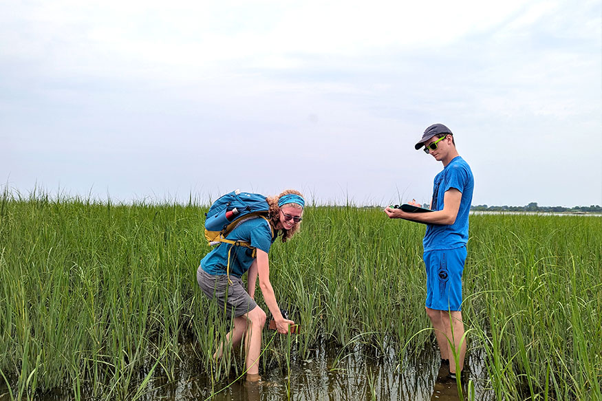
Some of the tidal marshes are dominated by low and high marsh (salt marshes) while others include more high marsh and upland habitats and exhibit more of a freshwater influence (brackish marshes). The marshes in the lower portion of Connecticut River are complexes of brackish marsh and tall reed marsh, often occurring within the same property (Barrett 1989). All marshes are highly-productive zones, providing food, shelter and breeding habitat for numerous invertebrates, fish and birds. Many of the brackish tidal wetlands along the Connecticut River have been recognized as wetlands of global importance by the Ramsar Convention (Dreyer and Caplis 2001; USFWS 1994).
Intertidal areas include rocky substrates, beach, and flats composed of mud and sand. The rocky intertidal areas support a more diverse assemblage of organisms, as there is a firm substrate for these organisms to hold onto. The intertidal beaches and flats support a less diverse area as the sediment shifts and moves with the waves and along-shore current.
Soft bottom (sandy and silt/mud/clay) dominated habitats are perhaps the most prevalent and least complex of the range of subtidal habitats in the Reserve area, but they are nevertheless important as many burrowing species adapt to life in these habitats. Tidal and storm currents form sand waves and sand ripples which, like rocks and fauna in more spatially complex habitats, provide refuge from current flows. The cohesive nature of fine silt and clay sediments as well as an abundance of nutrient rich material provide an optimal habitat for many infaunal and epifaunal invertebrates.
Boulder and gravel areas are the most spatially complex habitats. These areas range in structure from large piles of boulders to flat pavements of small cobbles and pebbles. The relative stability of rock substrates provides a home for many encrusting (including cold water corals and mobile organisms, and the crevices between and under boulders provide cover from predators and refuge from swift currents.
Explore
CT NERR Biotic Habitats
(((add link)))
1.b.iii. Ecological significance
The coastal and estuarine habitats of Long Island Sound and Fishers Island Sound, such as seagrasses, shellfish beds and salt marshes, provide a home, feeding area and nursery for marine fish, marine invertebrates, sea turtles, marine mammals, and birds. As foundational, biogenic habitats essential for marine biodiversity and function, seagrass, shellfish, and salt marsh ecosystems represent a source of food security for humans through recreational and commercial fishing activities, and nursery habitat provision for major fisheries along the eastern seaboard. As ecological engineers, the species forming the habitats create structures that stabilize sediments and dampen wave energy, helping reduce coastal erosion and the impacts of storms.
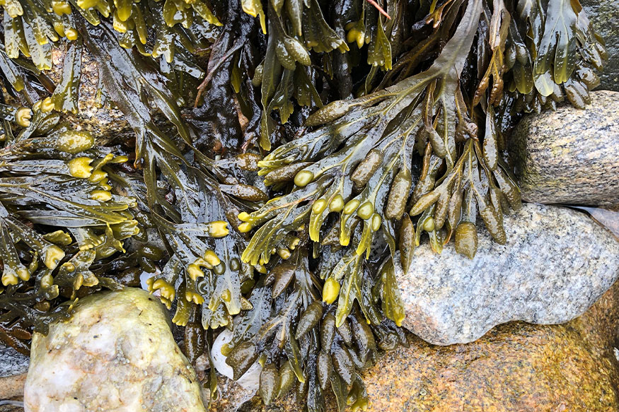
Submerged aquatic vegetation and macroalgae are often the dominant structure-forming organisms in the nearshore shallow waters. Like terrestrial grasses and trees, these primary producers provide dissolved oxygen, food, and shelter for organisms living within the habitat. Dense meadows of seagrass (submerged aquatic vegetation tolerant of higher salinity estuarine to marine waters) provide refuge from predators and tidal currents.
Seagrasses and salt marshes are also important carbon sinks, sequestering and storing up to ten times the amount of carbon by area as their terrestrial forest equivalents (Millenium Ecosystem Assessmen 2005; Valiela 2015). Whales, sea turtles, and fish that migrate or move between coastal, estuarine, and ocean habitats as they feed and reproduce, depend on Long Island Sound, Fishers Island Sound, the rivers, and offshore habitats throughout their life histories.[
1.b.iv. Overview of human dimensions
(((JV note – Reference the Blue Plan – a sentence or two about it, then link to Blue Plan. Other relevant viewers or data analyses?)))
The CTNERR exists within a region shaped by long standing interactions between human communities and coastal ecosystems. Southeastern Connecticut supports a diverse mix of residential, commercial, industrial, recreational, and conservation land uses that influence estuarine conditions.
The Reserve area and surrounding region support a wide range of ecosystem services, including fisheries, aquaculture, recreation, tourism, shoreline protection, and cultural heritage. These services contribute significantly to the regional economy and quality of life but also place demands on estuarine resources.
Climate change, sea level rise, pollution, and coastal development represent the most significant long term threats to both ecological integrity and human communities. Addressing these challenges requires integrated science, monitoring, and management approaches that are central to the mission of the CTNERR.
Human and climate related stressors to estuarine habitats include habitat loss and degradation, invasive species, pollution, marine debris, climate change, sea level rise, barrier/dams, human harassment, and fishing / overfishing. Descriptions of threats and potential impacts are included in Table 1. Threats to riparian and freshwater habitats include habitat degradation, habitat loss, invasive species, pollution, coastal development, sea level rise and its impact on saltwater intrusion, and climate change.
(((there is a very long table in the doc that I did not add)))

Deeper Dive
> Long Island Sound Blue Plan
> Long Island Sound Blue Plan Map Viewer
((((link colors need changing, this box could be smaller)))